Cycling route planning can be done using Google Maps, a widely used mapping application. Launch the Google Maps app on your smartphone or go to the Google Maps website on your computer to get started.
We have carefully outlined the step-by-step guidelines to set a cycling route on Google Maps. You should follow these steps:
1. Open Google Maps:
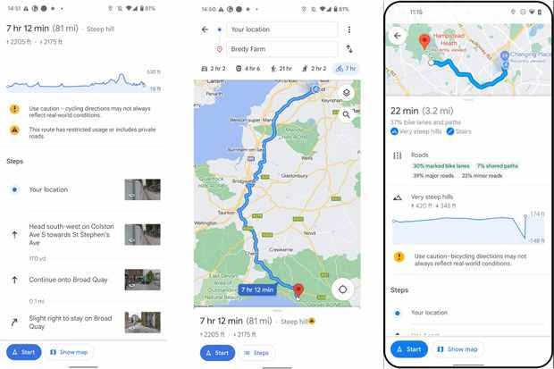
Once Google Maps is launched, you have access to the map interface or type the addresses to find your starting point and destination. Get turn-by-turn directions for your route using the “Directions” tool.
2. Enter your starting point:
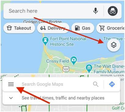
In the search field at the top of the screen, enter the address or name of your starting point to launch Google Maps. This could be a precise street address, the name of a city or town, or even a place of interest like a park or famous building.
3. Enter your destination:
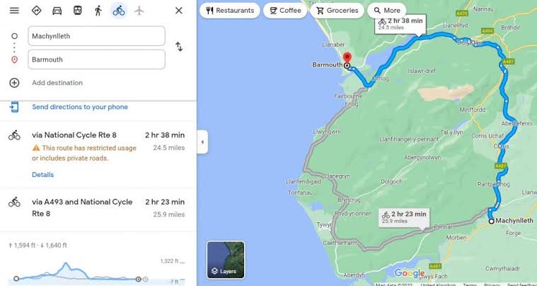
You need to enter the address or name of your destination into the search bar at the top of the screen in order to discover directions to a chosen location using Google Maps. It could be a particular street address, the name of a city or town, or even a place of interest like a restaurant or museum.
Google Maps will recommend locations that match your search terms as you begin to type in your search terms. Clicking on one of these choices will take you straight there on the map. You can also enter your destination using voice search if you’re using the Google Maps app on your smartphone.
4. Choose the cycling option:
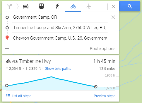
You can click on the “Directions” button or icon on Google Maps, which is typically a blue arrow or automobile icon, to acquire directions. Your starting location and destination can be entered in the directions options that appear after doing this.
5. Select the bicycle icon:
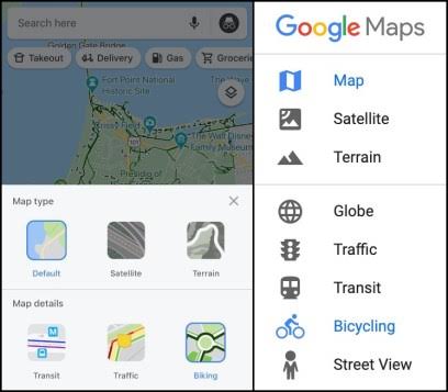
Among the various forms of mobility (auto, public transportation, walking), look for the icon of a bicycle. To select cycling as your favorite method of transportation, tap the bicycle icon.
6. View the cycling route:
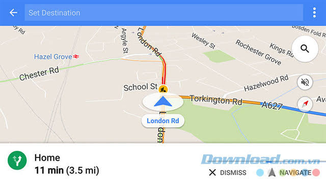
When you use Google Maps to find directions and choose the “Bicycling” layer, the map will provide a suggested path for cyclists to take between your starting point and destination. The route will give you with the safest and most effective way to get to your destination by taking into account bike lanes, cycling paths, and other bike-friendly routes.
To find the optimal riding route, Google Maps consults a range of data sources, including details on bike lanes, bike pathways, and bike-friendly roadways. The elevation variations along the route will also be shown on the map so you can plan your cycle appropriately.
7. Customize your route (optional):
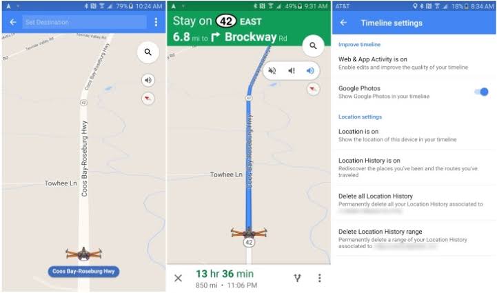
It’s necessary to select a path that fits your interests and degree of fitness when arranging a bicycle trip. Fortunately, you can adapt your route to fit your needs using a variety of online mapping tools and apps.
Drag the route line to manually add waypoints or change the path if you need to make any changes to the route. This may be helpful if you like to travel a certain route or stay away from a particular location. Consider taking a picturesque route that travels through parks or along the seaside rather than avoiding congested roads or hills.
8. Start navigation:
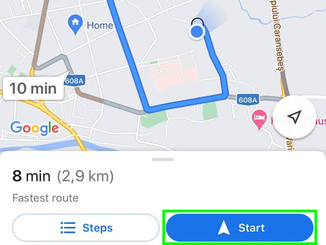
When you are comfortable with the route, touch the “Start” button to start the navigation process. For your bicycle journey, Google Maps will offer turn-by-turn directions with voice guidance and visual indications on the map. This can be particularly useful while negotiating new terrain or when you have a lot of turns to make.
In addition to providing real-time updates on your location and expected arrival time, Google Maps will also show you any turns or landmarks that are coming up as you ride. To examine extra information about your trip, such as elevation changes, bike pathways, and traffic conditions, use the “Bicycling” layer.
You can easily touch on the “Reroute” option to acquire new directions if you need to take a detour or alter your route for whatever reason. Additionally, if you’re ever unsure of where to go, you may utilize Google Maps’ “Explore” option to identify nearby attractions like eateries, gas stations, or bike shops.
FAQs:
Is Google Map bike time accurate?
Google Maps provides an estimated travel time for cycling routes based on a variety of factors, such as the distance of the route, the terrain, and the speed at which you are expected to ride.
While Google Maps provides a good estimate of the travel time for a cycling route, it may not always be completely accurate. It’s always a good idea to give yourself extra time when planning a ride, especially if you’re new to the area or if you’re not familiar with the terrain.
Can I cycle at home?
Yes, you can cycle at home using a stationary bike or an indoor cycling trainer. There are many different types of stationary bikes and trainers available, ranging from basic models with no frills to high-tech machines with advanced features like virtual reality simulations and personalized coaching programs.
Can we cycle instead of walking?
Yes, cycling is a great alternative to walking, especially for longer distances or when you need to get somewhere quickly. Cycling can be a faster and more efficient mode of transportation than walking, allowing you to cover more ground in less time. Additionally, cycling can be a low-impact form of exercise that is easy on your joints and can help improve your cardiovascular health, strengthen your muscles, and burn calories.
.
Conclusion:
In spite of the fact that Google Maps’ cycling feature is better developed in some areas than others, it’s important to keep in mind that the availability of bicycle routes may vary depending on your location. In conclusion, Google Maps can be a useful tool for organizing and navigating your bicycle routes, giving you the knowledge and direction you need to stay safe and have fun on your ride.

